Some myths examined, some truths revealed, some issues still to be resolved.
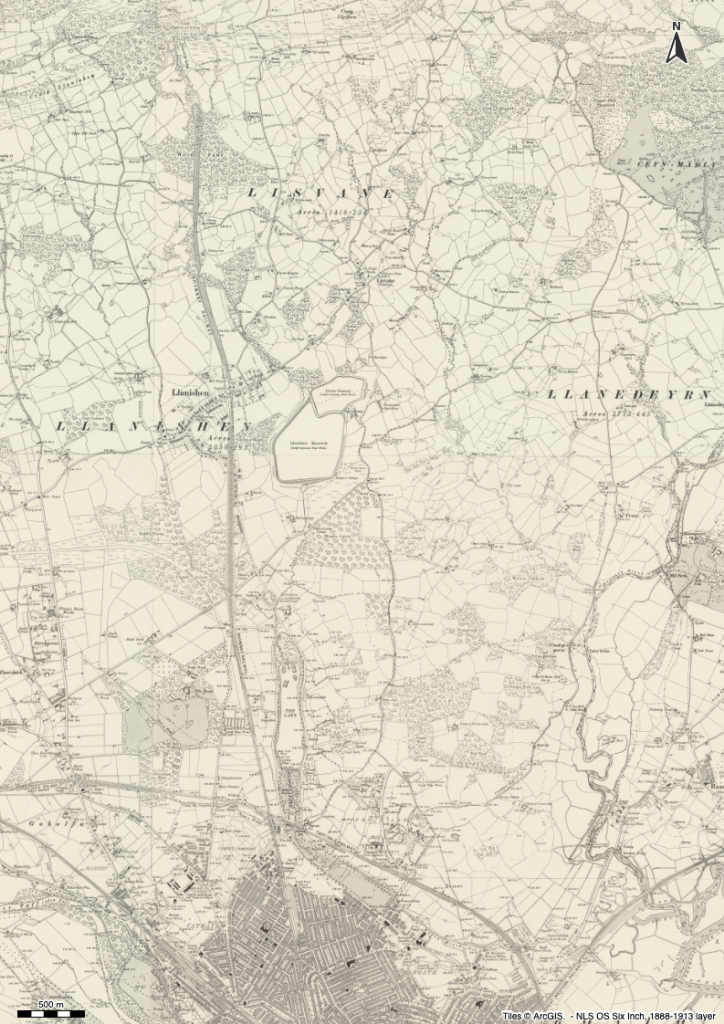
An overview of North Cardiff
In this short post, mainly consisting of maps I’ll talk about the suggested tramway that supplied building materials to the construction of the Lisvane and then Llanishen Reservoirs. Then show a couple of clips relating to the New Cemetery Station from Bob Price, and posing a question about another bit of railway masonry which I’d love to have explained to me. Finally, just look at how old Llanishen once looked and how Roath Park Lake came into existence.
It has been put to me on more than one occasion that there was a tramway that ran down from near where the old Cefn Onn station used to be to the reservoirs built by Cardiff Corporation. The map evidence suggests otherwise …
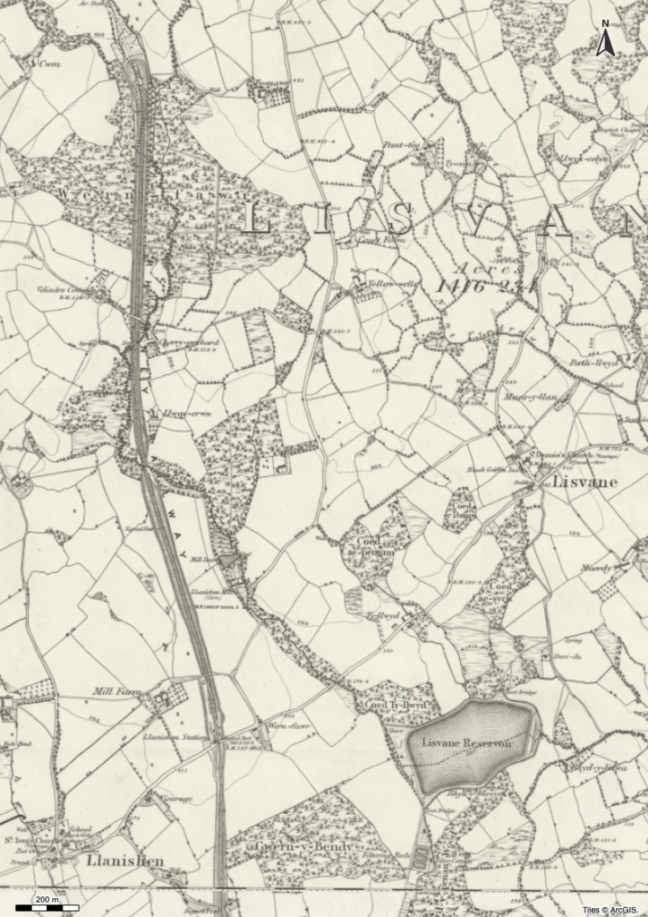
Lisvane Reservoir shown on map of OS 6″ First Series: 1840s – 1880s
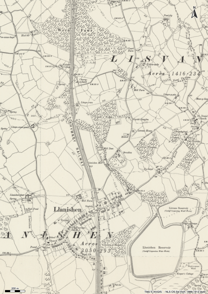
Lisvane & Llanishen Reservoirs shown on map of OS 6″ Second Series: 1888 – 1913
If you can find anything that looks like a tramway on these maps, please tell me!
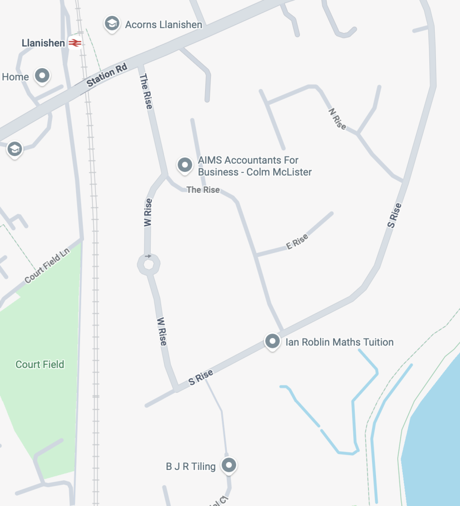
Literally, the day after I wrote that statement, I went back to Bob Price’s website (see link above), and watched his review of what he’d done in 2025 and he mentioned that he’d done some work on Llanishen Reservoir, which suggests (with further evidence in the comments below the video) that there was a link from just 200m south of the station crossing where west Rise, The Rise and presumably South Rise to the reservoirs. The link was short-lived, possibly only 3 years and was abandoned/demolished when the reservoirs were completed. There is however contradictory evidence mentioned in the video of the link coming down from north of Llanishen Station. Bob has indicated there’s another video on the subject to follow. I await that with some interest!
Bob Price has documented the old and missing stations in South Wales on his website and YouTube channel – well worth a visit, which helped me also understand a little more about my investigations into the railways that went through the Taff Gorge.
A couple of them captured my attention because I travel the line from Llanishen to Cardiff a fair bit.
So there was a “station” between Heath Halt (built later on) and Cardiff, but what about this piece of railway masonry on the north side of the Wedal Road bridge – was it connected to the wartime activity in Heath Park? It would be interesting to find out.
The “platform” only appears on the west side of the line – what is it?
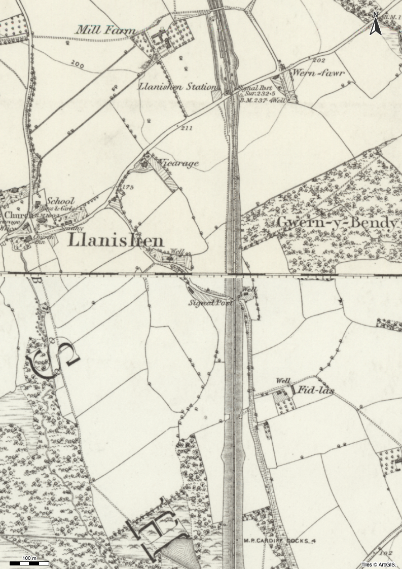
Finally, it’s always interesting to see bits and pieces of old Llanishen, the brick works for instance at Rhyd-y-penau, the Fid-las Farm and of course the fact that our house just doesn’t exist on the map.
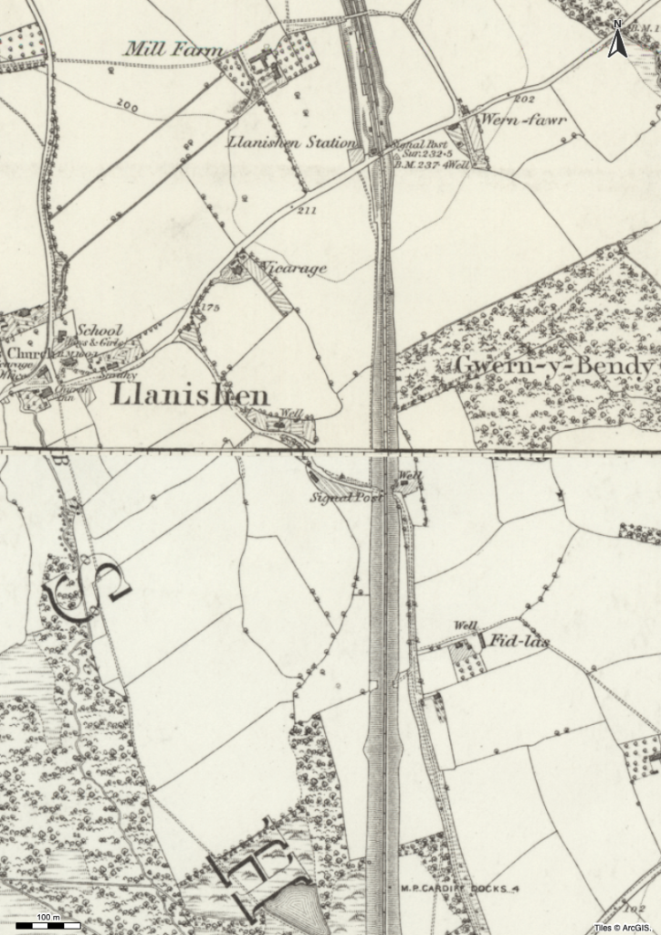
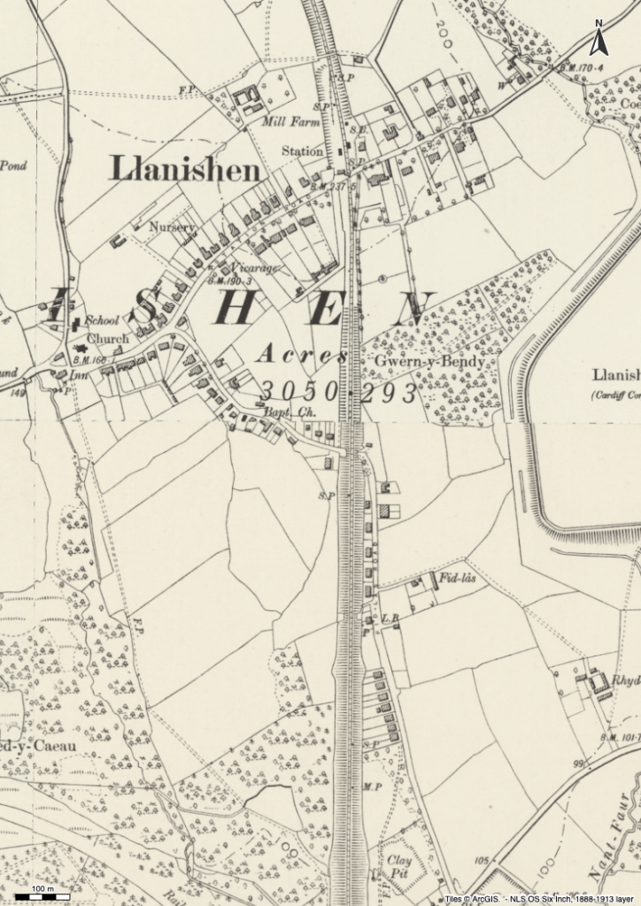
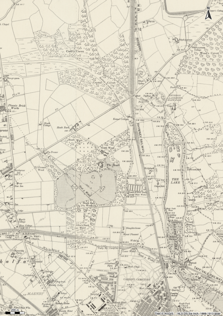
Finally, a couple of maps that show Roath Park Lake – before and after …
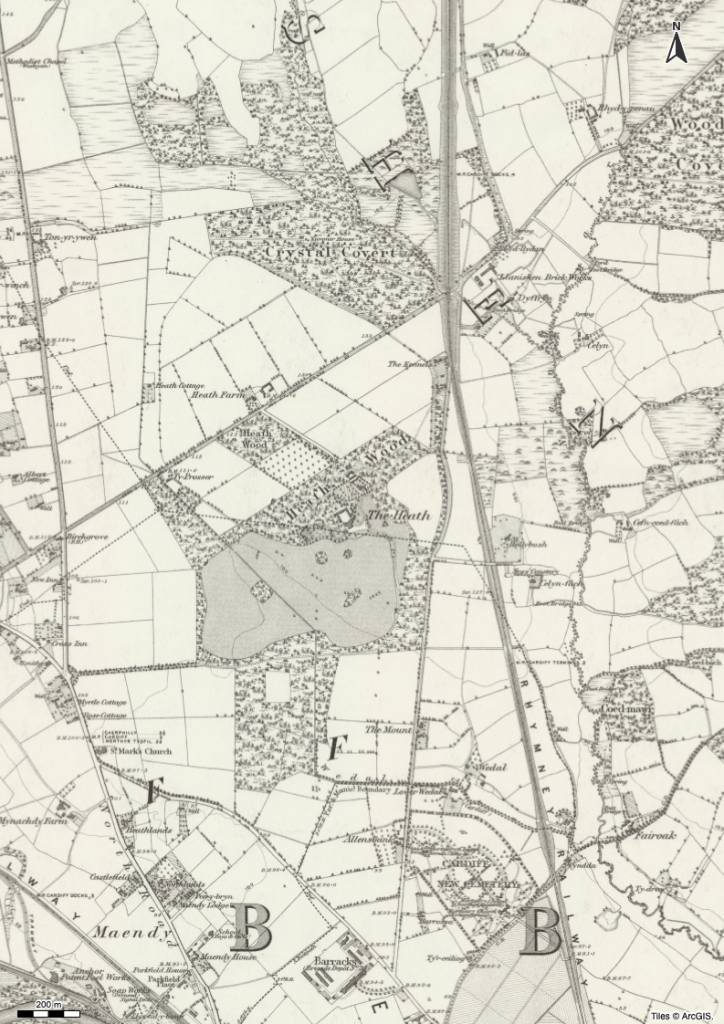
Note the disappearance of the Llanishen Brick Works and the emergence of Fiddles Road as the city began to expand at the beginning of the 20th century.
 So much to search for, the traces of a Cardiff that no longer exists. The railway stations that have gone (2); the covered canal (Churchill Way); the canal that’s moved (by the New Theatre); the canal tunnel(s) – Crockherbtown (Queen Street East) and beside the castle and Queen Street West; was there a canal “flyover” near the Law Courts; presumably the original route of the Glamorganshire Canal went down to meet the Taff before Brunel moved the river for his Great Western Station? I also didn’t know that Bute Street originally extended to The Hayes!